The first AI built for fiber and broadband

The way network
operators plan
just changed.

Describe a market. CompassAI builds the full project in minutes — production-ready HLD on ArcGIS, 10-year pro-forma, scenario comparisons, and a scored written evaluation. Plus permitting risk flagged per route, before a dollar is committed.

Tell Compass where you want to build. It produces a production-ready HLD on ArcGIS, models your financials with your cost assumptions, tests every scenario, writes the analysis, and flags the permitting load per route — federal, state, and local. Then keep refining in plain English: "now filter to incomes over $80K" — new scenario, instantly.
Build Evaluation — Miami County, KS
Ran 2 min ago
Map
Financials
Scenarios
Analysis
9
/12
Strong Opportunity
Median Age (41.2)2/2
Household Income ($72,400)2/2
Competition (≤1 provider, 68%)2/2
Avg Served Speed (94 Mbps)1/2
Miles/Passing (0.041)1/2
Density Response (+14.2 pts)1/2
AI Insight
Low competition and strong income profile — near-greenfield opportunity. Dense core IRR of 24.1% at density ≥ 60. This county builds well.
IRR by density threshold — best build configuration
density ≥ 60
24.1%
density ≥ 45
19.3%
density ≥ 30
14.8%
full footprint
8.2%
Permitting Risk Medium — franchise dependency on preferred route
Built for
Rural Broadband Operators Regional ISPs & CLECs Fiber & FWA Providers NTCA Members Network Finance Teams

90 seconds. One complete market evaluation.

Watch CompassAI evaluate Miami County, KS — from a single prompt to a scored, written build recommendation.

Miami County, KS — Built on ArcGIS · Narrated walkthrough

Why trust us

We're not an AI company
that learned fiber.
We're fiber planners who built AI.

Our team spent years doing what CompassAI now does in minutes — designing fiber networks, modeling build economics, and helping operators make defensible capital decisions. Last year alone we supported over $2B in BEAD funding applications and designed networks across millions of miles of territory.

We took that methodology, encoded it into software, and made it available to any operator. CompassAI is that same analytical framework, running at machine speed — and at a scale manual analysis can't reach.

$2B+
in BEAD funding applications supported in the last year
Millions
of miles of fiber network designed using this methodology
All 50
states covered — rural, suburban, tribal, and municipal markets

Six views. One complete picture.

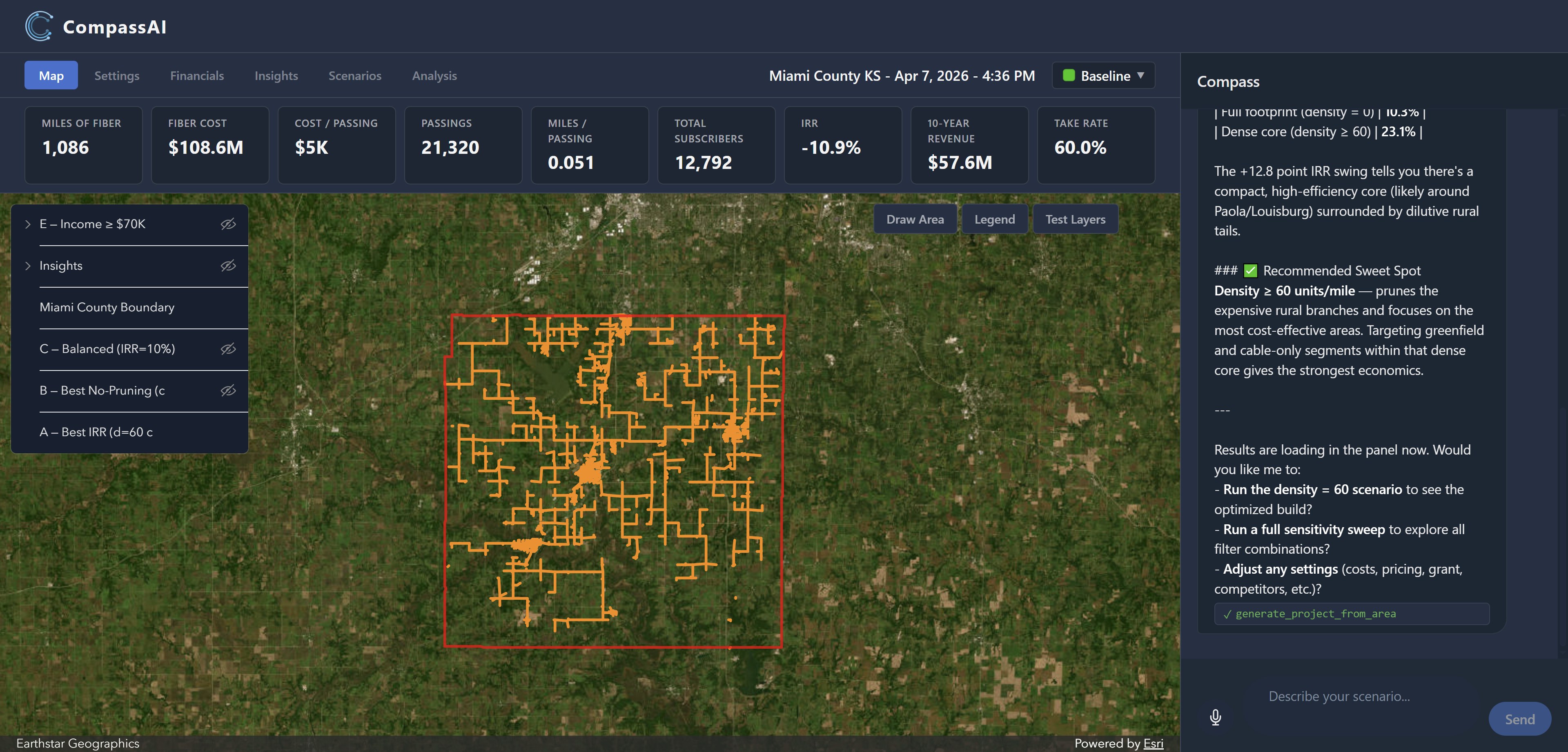
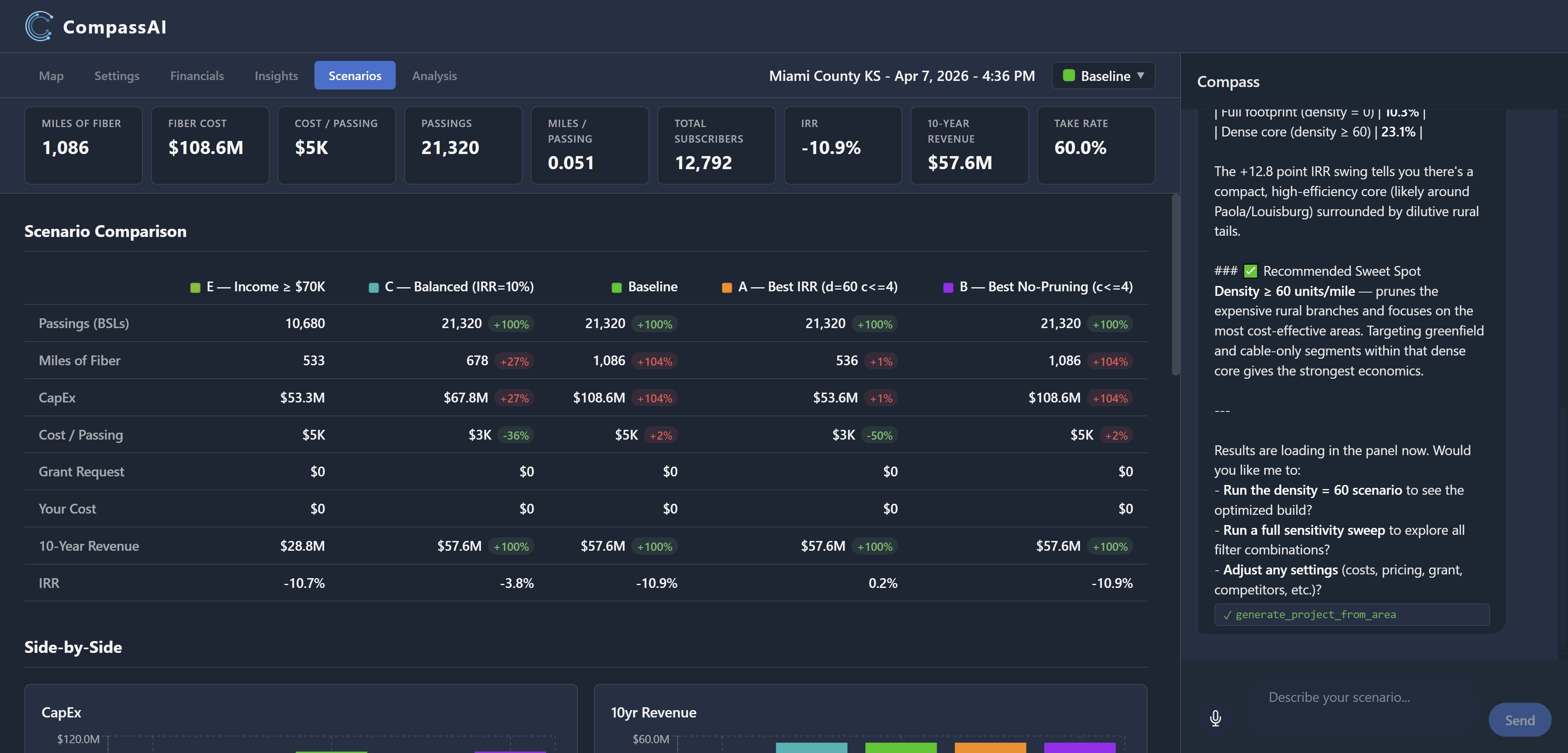
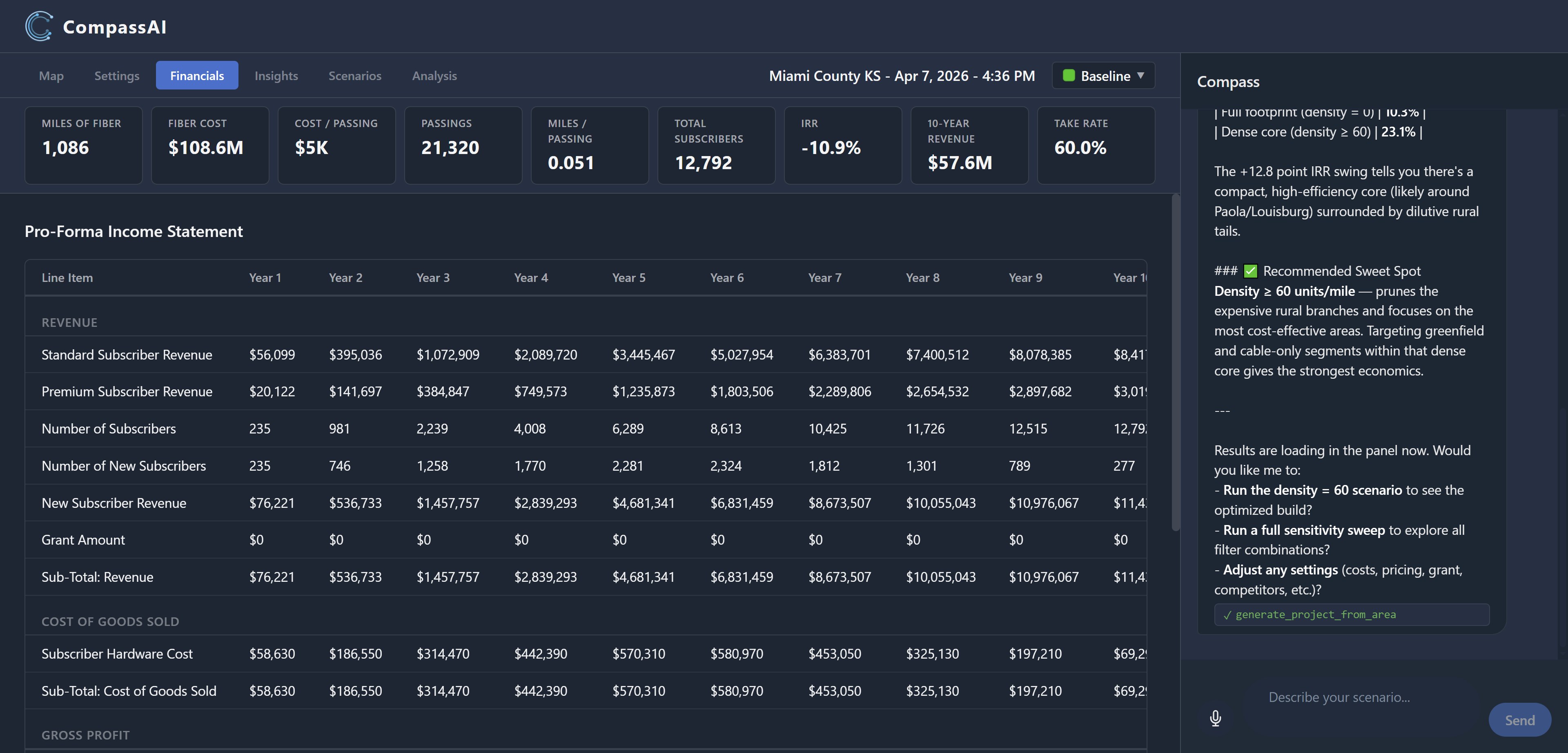
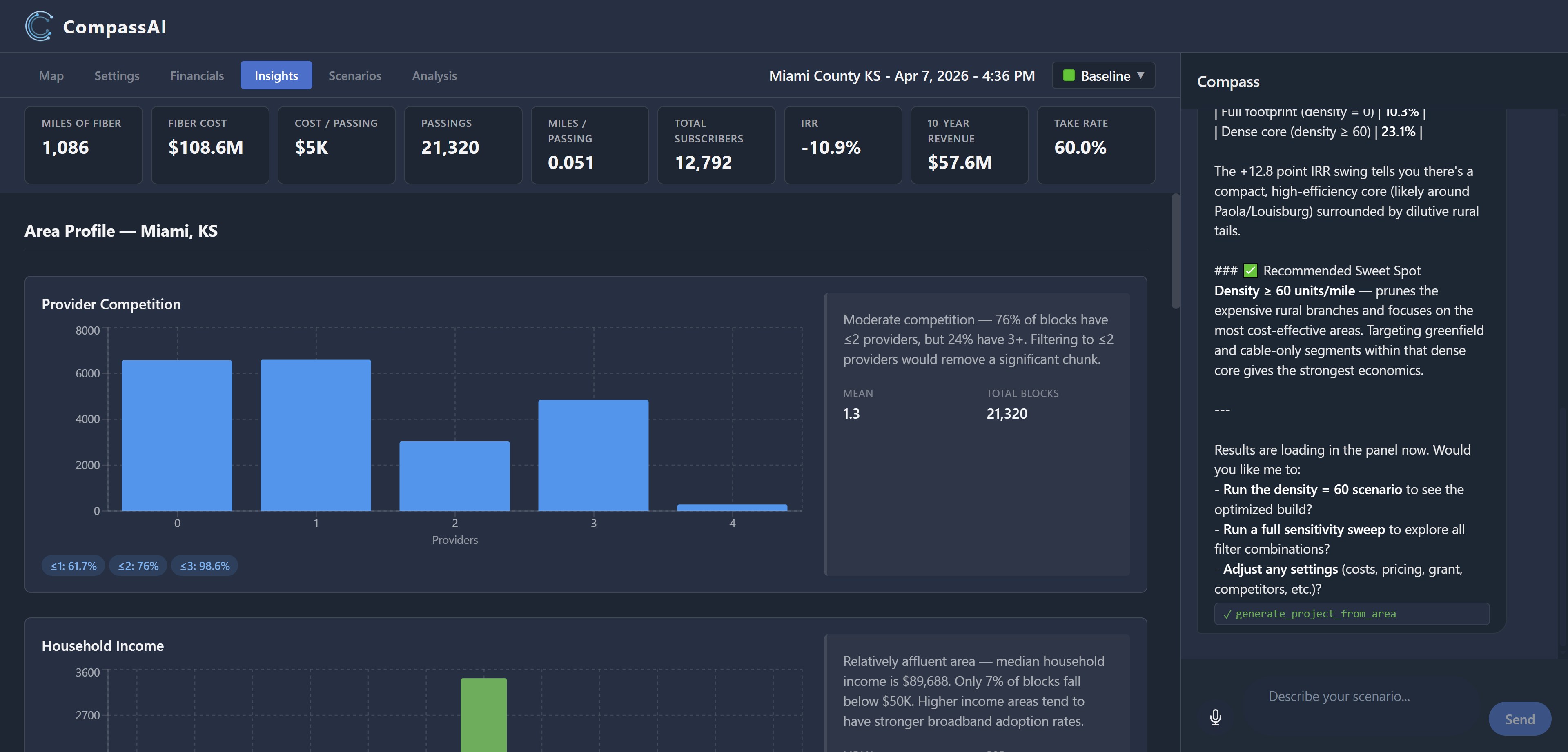
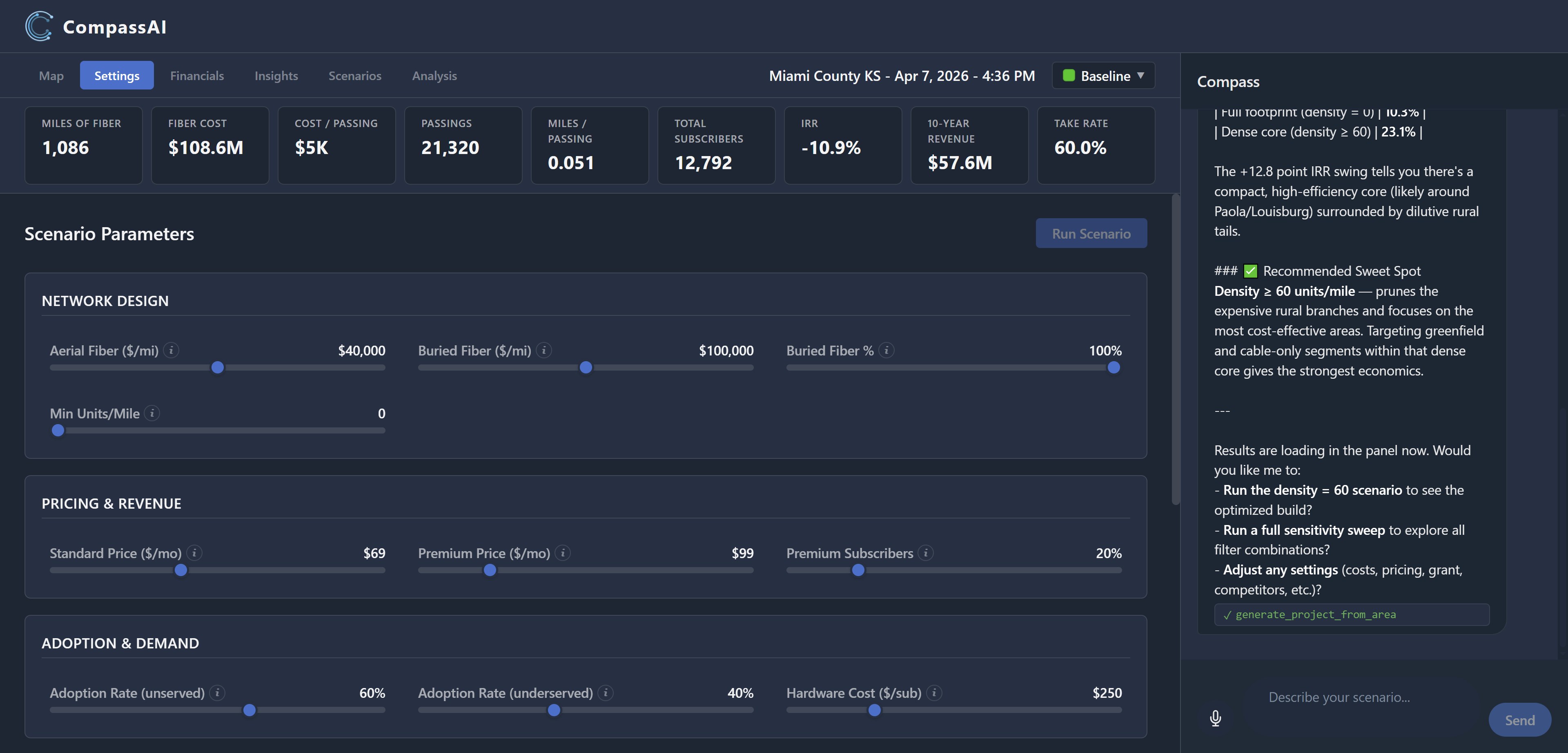
CompassAI is a full planning environment — map, model, insights, scenarios, and AI analysis, all connected.
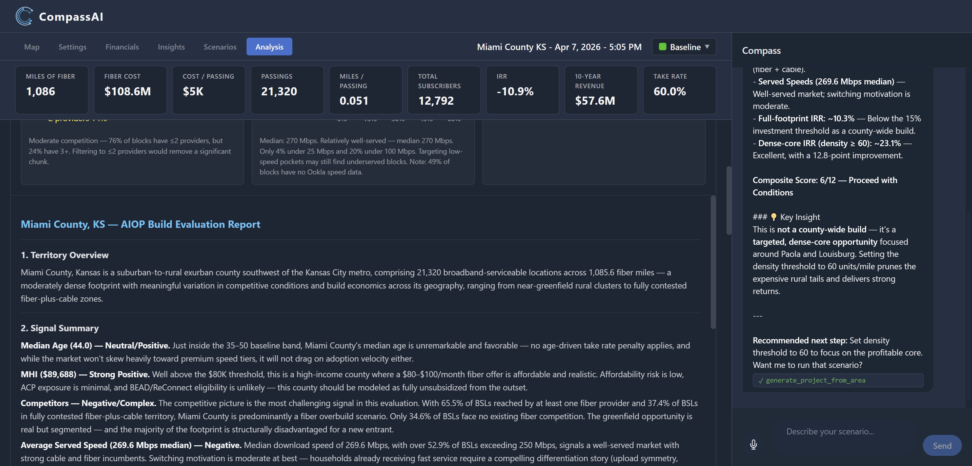
Weeks of analysis, in minutes — plus the thousand scenarios you could never run by hand.

CompassAI doesn't just score markets — it reasons about them, at a scale analyst teams can't match. Every analysis includes a production-ready HLD, a full written report, a composite score, and a clear recommendation.

01
Your financial model, your assumptions
Set your aerial and buried fiber cost, ARPU tiers, adoption rates, grant percentage, and discount rate. Pre-loaded with real-world deployment benchmarks — adjust to match your market and your costs.
02
Composite market score — X/12
Every market is scored across six signals and tested at dozens of filter combinations. CompassAI identifies the optimal build configuration — the exact settings that maximize IRR. Not guessed. Computed.
03
Written analyst narrative
A professional-grade written evaluation — territory overview, signal-by-signal rationale, network design insight, and build priority ranking by competitive segment. The kind of analysis that takes an analyst team weeks.
04
A verdict you can defend
"Build Now." "Proceed with Conditions." "High Caution." A labeled recommendation backed by data and reasoning — with the production-ready HLD on ArcGIS showing exactly where to build.
Build Evaluation Report
AI Generated
9/12
Strong Opportunity
Miami County, KS
A predominantly underserved rural county with strong income demographics and minimal fiber competition. The dense core builds at 24.1% IRR — clear, defensible build case.
Median Age (41.2)
Strong Positive
MHI ($72,400)
Strong Positive
Competition (≤1 provider)
Strong Positive
Avg Speed (94 Mbps)
Neutral
Mi/Passing (0.041)
Positive
Density Response (+14.2 pts)
Strong Positive
Sweet Spot
density ≥ 60, competitors ≤ 2 — 8,400 BSLs in dense greenfield core, rural tails pruned.
24.1% IRR  ·  $14.2M CapEx  ·  467 fiber miles

"This route has 200 permits. That one has 50."

The expensive surprise on a fiber build isn't the map — it's the permitting load you discover after capital is committed. CompassAI flags it before.

01
Federal layers, per route
Federal lands, tribal lands, wetlands, railroad crossings, and ESA critical habitat — live spatial intersection against authoritative federal layers. Every route segment labeled with exactly what it triggers.
02
State and local, by jurisdiction
State D.O.T. encroachments, county right-of-way, municipal franchise agreements, 811 — loaded from a per-jurisdiction knowledge base with named contacts and process flows. Not "contact the county." Name, phone, email.
03
Per-scenario comparison
Every scenario you build gets its own permitting analysis — so the CapEx-cheap route that gets stuck in a franchise negotiation shows up next to the route that actually clears.
04
We flag risk. You file permits.
CompassAI isn't a filing service. It replaces the expensive surprise — catching the permit load before capital is committed, not after the trenchers are on site.
Permitting Risk Report
Per Scenario
Medium
Franchise dependency
Miami County, KS — Best IRR scenario
Osawatomie franchise agreement required before any municipal permit can be issued — sequence-critical, not fee-critical. Engage 90 days ahead of construction.
Federal lands crossed
None
Wetlands intersected
3 segments
Rail crossings
2 — BNSF
County ROW permits
Miami Co. — standard
Municipal franchise
Osawatomie required
ESA critical habitat
None
Route comparison
Best IRR route: 47 distinct permits, franchise-blocked. Balanced route: 28 permits, no franchise dependency.

Build. Refine. Analyze. Decide.

CompassAI is built on ArcGIS — the industry-standard geospatial platform used across broadband infrastructure planning — with a purpose-built AI layer that turns the map into a planning conversation.

1
Describe your market
Tell CompassAI what you want to build — and upload your existing network so it plans around what you already have. It produces a production-ready HLD on ArcGIS and loads all market data automatically.
You say"Build me a fiber plan for Miami County, KS — $40k/mi aerial, 60% take rate."
2
Refine with follow-up instructions
Keep narrowing: "now build only to incomes over $80K" or "filter out areas with 3+ competitors." Each instruction builds a new scenario on the map instantly — real build options, not just numbers.
You say"Now show me just the dense core — density over 60 and greenfield only."
3
Read the AI evaluation
CompassAI tests every combination of density, competition, and income parameters, then writes a full market evaluation — scored signals, network design insight, build priority ranking, composite score, labeled verdict.
Output"9/12 — Strong Opportunity. Dense core builds at 24.1% IRR. Build Now."
4
Make the call
Walk into your board meeting or capital planning session with a scored, written, defensible market analysis — every assumption documented, every number traceable back to the model.
ExportBoard summary, full evaluation report, scenario comparison table.

Your team, operating at a different level.

An experienced analyst team gives large telcos a powerful combination: deep domain expertise plus analytical horsepower. CompassAI gives that same combination to any operator — permanently embedded, always available, and operating at a scale no analyst team can match by hand.

Before
Your team + gut feel
Old alternative
Analyst team + weeks
With CompassAI
Your team × CompassAI
🧠
Real expertise, encoded
CompassAI encodes the analytical framework used to plan billions of dollars of fiber deployment — broadband market dynamics, build economics, competitive displacement, capital efficiency — applied to your specific market.
A different scale of analysis
An analyst team can compare a handful of scenarios. CompassAI compares a thousand — every density threshold, every income cut, every competitive filter — and reports the configuration that actually maximizes IRR. Not just faster analysis. A different shape of analysis.
🗺️
Industry-standard foundation
Built on ArcGIS — the same geospatial platform used across the broadband industry. The AI layer makes it accessible to any operator, not just GIS-trained specialists.

One plan. Everything included.

Founding Rate
$199
per seat · per month*
  • Full AI planning environment — map, financials, scenarios, analysis
  • Proprietary location dataset included — no separate data license needed
  • Upload your existing network — brownfield-aware planning from day one
  • Unlimited market scoring, scenario modeling, and build comparisons
  • AI-written evaluation reports with composite scoring
  • Board-ready exports and full evaluation reports

Month-to-month. Cancel anytime — no annual contract.

* - Restrictions Apply

The network AI your competitors
don't have yet.

Book a 30-minute session with Mike Houston. Bring a real market — we'll build it live together.

Usually available within 48 hours. No slides. No pitch deck.